File:Azerbaijan (orthographic projection).svg

Dimensioni di questa anteprima PNG per questo file SVG: 551 x 551 pixel. Autra resoluzions: 240 x 240 pixel | 480 x 480 pixel | 768 x 768 pixel | 1 024 x 1 024 pixel | 2 048 x 2 048 pixel.
Documënt uriginel (file tl format SVG, dimenjiuns nominales 551 × 551 pixels, dimenjiun dl file: 570 KB)
Ressumé
| Descriziun |
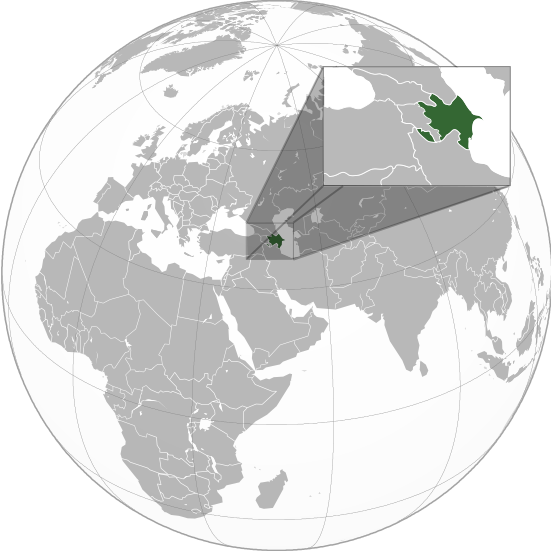
English: Orthographic Projection Map of Azerbaijan.
The other orthographic projection maps. .svg) |
| Data | |
| Funtana | Opera personala |
| Autur | en:User:Night w |
.svg)
.svg)
.svg)
.svg)
.svg)
.svg)
.svg)
.svg)
.svg)
.svg)
.svg)
.svg)
.svg)
.svg)
.svg)
.svg)
.svg)
.svg)
.svg)
.svg)
.svg)
.svg)
.svg)
.svg)
.svg)
.svg)
.svg)
.svg)
.svg)
.svg)
.svg)
.svg)
.svg)
.svg)
.svg)
.svg)
.svg)
.svg)
.svg)
.svg)
.svg)
.svg)
.svg)
.svg)
.svg)
.svg)
.svg)
.svg)
.svg)
.svg)
.svg)
.svg)
.svg)
.svg)
.svg)
.svg)
.svg)
.svg)
.svg)
.svg)
.svg)
.svg)
.svg)
.svg)
.svg)
.svg)
.svg)
.svg)
.svg)
.svg)
.svg)
.svg)
.svg)

.svg)

.svg)

.svg)
.svg)
.svg)
.svg)
.svg)
.svg)
.svg)


.svg)
.svg)
.svg)
.svg)
.svg)
.svg)
.svg)

.svg)
.svg)
.svg)
.svg)
.svg)
.svg)
.svg)
.svg)
.svg)

.svg)
.svg)
.svg)
.svg)
.svg)
.svg)
.svg)
_without_national_boundaries.svg)
.svg)
.svg)
.svg)
.svg)
.svg)
.svg)

.svg)
.svg)
.png)
.svg)
.svg)
.svg)
.svg)

.svg)
.svg)
.svg)
.svg)
.svg)
.svg)
.svg)
.svg)
.svg)
.svg)
.svg)

.svg)
.svg)
.svg)
.svg)
.svg)
.svg)
.svg)
.svg)
.svg)

.svg)
.svg)

.svg)
.svg)
.svg)
.svg)
.svg)
.svg)
.svg)
.svg)
.svg)
.svg)
.svg)
.svg)
.svg)
.svg)
.svg)
.svg)
.svg)
.svg)
.svg)
.svg)
.svg)
.svg)
.svg)
.svg)
.svg)
.svg)
.svg)
_-_Crimea_disputed.svg)
.svg)
.svg)
.svg)
.svg)
.svg)
.svg)
.svg)
.svg)
.svg)
.svg)
.svg)
_political.svg)
.svg)
.svg)
.svg)
.svg)
_-_Crimea_disputed_-_no_borders.svg)
.svg)
.svg)
.svg)
.svg)
.svg)
.svg)
.svg)
.svg)
.svg)
.svg)
.svg)

.svg)
.svg)
.svg)

.png)
.svg)
.svg)
.svg)
.svg)
.svg)
.svg)
.svg)
.svg)
.svg)
.svg)
.svg)
.svg)
.svg)
.svg)
.svg)
.svg)
.svg)
.svg)
.svg)
.svg)
.svg)
.svg)
.svg)
.svg)
.svg)
.svg)
.svg)
.svg)
.svg)
.svg)
.svg)
.svg)
.svg)
.svg)
.png)
.svg)
.svg)
.svg)
_(orthographic_projection).png)
.svg)
Lizënza
Io, detentore del copyright su quest'opera, dichiaro di pubblicarla con le seguenti licenze:

|
AL é la lizënza da copié, da dé inant y/o müdé chësc documënt aladô dla lizënza GNU Free Documentation License, Verjiun 1.2 o vigni atra verjiun suandënta publicada dala Free Software Foundation; zënza seziuns che ara ne vá nia da mudé, zënza test söl cuertl ca dant y do ia. Na copia dla lizënza é tla seziun cun le titul Test dla GNU Free Documentation License. |
Chësc file á la lizënza de destribuziun aladô dla lizënza Creative Commons Attribution-Share Alike 3.0 Unported.
- Tu ies liede:
- da spartì – per cupié, spartësc y manda l lëur
- da mudé – da adaté al lëur
- A chësta condizions:
- atribuzion – Tu mues atribué l lëur te la maniera che à spiegà l autëur o chël che à la lizënza (ma nia te na maniera che l smea che ëi te paiessa).
- fá na condivijiun tla medema manira – Sce te mudes o svilupeies chësc test, pudres mé spartì ora l lëur sota la medema lizënza o una che ti smea a chësta same or compatible license
Pos chirí fora la lizënza che as plü ion
Registro originale del caricamento
The original description page was on en.wikipedia (file log). All following user names refer to en.wikipedia.
.svg)
- 23:49, 20 April 2011 (UTC) Sisyphos23 551×551 (557 KB)
- 14:15, 15 April 2011 (UTC) Chipmunkdavis 551×551 (568 KB) (Sharpening smaller image)
- 09:57, 15 April 2011 (UTC) Dbachmann 551×551 (577 KB) (suggestion)
- 23:05, 14 April 2011 (UTC) Night w 551×551 (571 KB) (trying to colour)
- 22:58, 14 April 2011 (UTC) Night w 551×551 (575 KB) ({{Information |Description={{en|1=Azerbaijan}} |Source=Own work |Author=Night w |Date=2011-04 |Permission= |other_versions={{User:Ssolbergj/orthographic}} }} == {{int:license}} == {{self|cc-by-sa-3.0|GFDL|migration=redundant}} {{ImageNot)
Storia dl documënt
Druca sun na data/ëura per udëi l documënt coche l fo te chël mumënt.
.svg&dir=prev)
.svg&offset=20160827021508)
.svg&offset=&limit=20)
.svg&offset=&limit=50)
.svg&offset=&limit=100)
.svg&offset=&limit=250)
.svg&offset=&limit=500)
| Data/Ëura | Miniatura | Grandëza | utënt | Cumentar | |
|---|---|---|---|---|---|
| atuel | 03:36, 23 mer 2023 | | 551 × 551 (570 KB) | M.Bitton | Reverted to version as of 09:05, 14 September 2022 (UTC): per COM:OVERWRITE |
| 15:56, 22 mer 2023 |  | 689 × 689 (445 KB) | Multituberculata | ||
| 01:29, 17 sët 2022 |  | 551 × 551 (570 KB) | M.Bitton | Reverted to version as of 09:05, 14 September 2022 (UTC): per COM:OVERWRITE | |
| 23:54, 16 sët 2022 |  | 689 × 689 (445 KB) | Hogweard | Issues fixed - and South Sudan border added | |
| 11:05, 14 sët 2022 |  | 551 × 551 (570 KB) | Toghrul R | Reverted to version as of 15:45, 29 August 2016 (UTC) the Middle East region and Europe were broken, reverting to the previous version without South Sudan; waiting for the fix | |
| 20:00, 13 dez 2019 |  | 551 × 551 (421 KB) | Goran tek-en | Added border for South Sudan as requested by {{u|Maphobbyist}} | |
| 17:45, 29 ago 2016 |  | 551 × 551 (570 KB) | Artoxx | Reverted to version as of 15:31, 19 April 2016 (UTC) | |
| 17:44, 29 ago 2016 |  | 551 × 551 (190 KB) | Artoxx | Reverted to version as of 02:15, 27 August 2016 (UTC) | |
| 04:16, 27 ago 2016 |  | 551 × 551 (190 KB) | MosMusy | Georgia and Moldova have their main maps with territories not under control shaded. | |
| 04:15, 27 ago 2016 |  | 551 × 551 (190 KB) | MosMusy | Moldova and Georgia's map all have shading for territory not under their government's control. |
Coche l document ie stat adurvà
Chësta plata adroa chësc documënt:
Coche l documënt ie stat adurvà ntëur l mond
Ënghe chësta wikis adroa chësc documënt:
- Adurvà sun af.wikipedia.org
- Adurvà sun ami.wikipedia.org
- Adurvà sun arc.wikipedia.org
- Adurvà sun ar.wikipedia.org
- قائمة الدول ذات السيادة والأقاليم التابعة في آسيا
- مستخدم:جار الله/قائمة صور مقالات العلاقات الثنائية
- العلاقات الأذربيجانية الأمريكية
- العلاقات الأذربيجانية الأنغولية
- العلاقات الأذربيجانية الكورية الجنوبية
- العلاقات الأذربيجانية الإريترية
- العلاقات الأذربيجانية السويسرية
- العلاقات الأذربيجانية الألمانية
- العلاقات الأذربيجانية الليختنشتانية
- العلاقات الأذربيجانية البوليفية
- العلاقات الأذربيجانية الموزمبيقية
- العلاقات الأذربيجانية الألبانية
- العلاقات الأذربيجانية البلجيكية
- العلاقات الأذربيجانية الإثيوبية
- العلاقات الأذربيجانية البيلاروسية
- العلاقات الأذربيجانية الطاجيكستانية
- العلاقات الأذربيجانية الرومانية
- العلاقات الأذربيجانية الأرجنتينية
- العلاقات الأذربيجانية الغامبية
- العلاقات الأذربيجانية القبرصية
- العلاقات الأذربيجانية السيراليونية
- العلاقات الأذربيجانية النيبالية
- العلاقات الأذربيجانية الليبيرية
- العلاقات الأذربيجانية التشيكية
- العلاقات الأذربيجانية الميانمارية
- العلاقات الأذربيجانية الكندية
- العلاقات الأذربيجانية الزيمبابوية
- العلاقات الأذربيجانية البالاوية
- العلاقات الأذربيجانية النيجيرية
- العلاقات الأذربيجانية اليمنية
- العلاقات الأذربيجانية الفانواتية
- العلاقات الأذربيجانية الغابونية
- العلاقات الأذربيجانية البنمية
- العلاقات الأذربيجانية الكوبية
- العلاقات الأذربيجانية الجورجية
- العلاقات الأذربيجانية التونسية
- العلاقات الأذربيجانية الكورية الشمالية
- العلاقات الأذربيجانية الهندية
- العلاقات الأذربيجانية اليابانية
- العلاقات الأذربيجانية الإيطالية
- العلاقات الأذربيجانية الناوروية
- العلاقات الأذربيجانية الأسترالية
- العلاقات الأذربيجانية الزامبية
- العلاقات الأذربيجانية الفيجية
- العلاقات الأذربيجانية المارشالية
- العلاقات الأذربيجانية المالية
Mostra utilisaziun globala de chësc file.
.svg)
.svg)