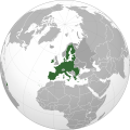
File:Europe and the European Union.svg

Dimensioni di questa anteprima PNG per questo file SVG: 550 x 550 pixel. Autra resoluzions: 240 x 240 pixel | 480 x 480 pixel | 768 x 768 pixel | 1 024 x 1 024 pixel | 2 048 x 2 048 pixel.
Documënt uriginel (file tl format SVG, dimenjiuns nominales 550 × 550 pixels, dimenjiun dl file: 1,4 MB)
Storia dl documënt
Druca sun na data/ëura per udëi l documënt coche l fo te chël mumënt.
| Data/Ëura | Miniatura | Grandëza | utënt | Cumentar | |
|---|---|---|---|---|---|
| atuel | 15:07, 16 sët 2022 |  | 550 × 550 (1,4 MB) | M.Bitton | Reverted to version as of 12:02, 4 September 2022 (UTC): I'm not interested in your POV, so stop edit warring or you'll be reported to the admins |
| 10:41, 16 sët 2022 |  | 550 × 550 (1,62 MB) | Рагин1987 | I repeat: this edit does not contradict the requirements of your request, please read the discussion page carefully. Uploading a new file because of such a small correction is not the point. | |
| 14:02, 4 sët 2022 |  | 550 × 550 (1,4 MB) | M.Bitton | Reverted to version as of 21:02, 3 September 2022 (UTC): it doesn't need fixing | |
| 12:29, 4 sët 2022 |  | 550 × 550 (1,61 MB) | Рагин1987 | Fixed Georgia (thanks for the note) | |
| 23:02, 3 sët 2022 |  | 550 × 550 (1,4 MB) | M.Bitton | Reverted to version as of 18:12, 13 April 2022 (UTC): don't replace my map with a fake svg | |
| 18:19, 3 sët 2022 |  | 2 048 × 2 048 (1 022 KB) | Рагин1987 | More correct visualization of the dividing line on the territory of the Caucasus Range | |
| 20:12, 13 aur 2022 |  | 550 × 550 (1,4 MB) | M.Bitton | Reverted to version as of 19:56, 3 March 2022 (UTC): per en:Wikipedia:Graphics_Lab/Map_workshop/Archive/Jan_2022#Request:_European_Union_map_with_highlighted_Europe_continent | |
| 18:54, 13 aur 2022 |  | 550 × 550 (1,61 MB) | Giorgi Balakhadze | EU sees GE AZ AM as Europe | |
| 21:56, 3 mer 2022 |  | 550 × 550 (1,4 MB) | M.Bitton | reduced the contrast | |
| 17:12, 3 mer 2022 |  | 550 × 550 (1,4 MB) | M.Bitton | Added missing Islands |
Coche l document ie stat adurvà
Chësta plata adroa chësc documënt:
Coche l documënt ie stat adurvà ntëur l mond
Ënghe chësta wikis adroa chësc documënt:
- Adurvà sun am.wikipedia.org
- Adurvà sun be.wikipedia.org
- Adurvà sun cs.wikipedia.org
- Adurvà sun cy.wikipedia.org
- Adurvà sun en.wikipedia.org
- Adurvà sun fa.wikipedia.org
- Adurvà sun glk.wikipedia.org
- Adurvà sun incubator.wikimedia.org
- Adurvà sun mdf.wikipedia.org
- Adurvà sun nn.wikipedia.org
- Adurvà sun rue.wikipedia.org
- Adurvà sun ta.wikipedia.org
- Adurvà sun uk.wikipedia.org