File:Georgia (orthographic projection).svg

Dimensioni di questa anteprima PNG per questo file SVG: 553 x 553 pixel. Autra resoluzions: 240 x 240 pixel | 480 x 480 pixel | 768 x 768 pixel | 1 024 x 1 024 pixel | 2 048 x 2 048 pixel.
Documënt uriginel (file tl format SVG, dimenjiuns nominales 553 × 553 pixels, dimenjiun dl file: 302 KB)
Ressumé
| Descriziun |
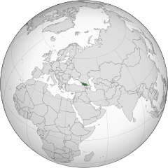
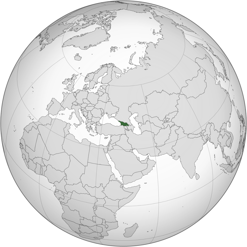
English: Location of Georgia.
.svg) |
| Data | |
| Funtana | Opera personala |
| Autur | Izzedine |
| Altre versioni |
.svg) .svg) |
| SVG sviluppo | Questa mappa in grafica vettoriale è stata creata con Inkscape. |
.svg)
.svg)
.svg)
.svg)
.svg)
.svg)
.svg)
.svg)
.svg)
.svg)
.svg)
.svg)
.svg)
.svg)
.svg)
.svg)
.svg)
.svg)
.svg)
.svg)
.svg)
.svg)
.svg)
.svg)
.svg)
.svg)
.svg)
.svg)
.svg)
.svg)
.svg)
.svg)
.svg)
.svg)
.svg)
.svg)
.svg)
.svg)
.svg)
.svg)
.svg)
.svg)
.svg)
.svg)
.svg)
.svg)
.svg)
.svg)
.svg)
.svg)
.svg)
.svg)
.svg)
.svg)
.svg)
.svg)
.svg)
.svg)
.svg)
.svg)
.svg)
.svg)
.svg)
.svg)
.svg)
.svg)
.svg)
.svg)
.svg)
.svg)
.svg)
.svg)
.svg)

.svg)

.svg)

.svg)
.svg)
.svg)
.svg)
.svg)
.svg)
.svg)


.svg)
.svg)
.svg)
.svg)
.svg)
.svg)
.svg)

.svg)
.svg)
.svg)
.svg)
.svg)
.svg)
.svg)
.svg)
.svg)
.svg)

.svg)
.svg)
.svg)
.svg)
.svg)
.svg)
.svg)
_without_national_boundaries.svg)
.svg)
.svg)
.svg)
.svg)
.svg)
.svg)

.svg)
.svg)
.png)
.svg)
.svg)

.svg)
.svg)
.svg)
.svg)
.svg)
.svg)
.svg)
.svg)
.svg)
.svg)
.svg)

.svg)
.svg)
.svg)
.svg)
.svg)
.svg)
.svg)
.svg)
.svg)

.svg)
.svg)

.svg)
.svg)
.svg)
.svg)
.svg)
.svg)
.svg)
.svg)
.svg)
.svg)
.svg)
.svg)
.svg)
.svg)
.svg)
.svg)
.svg)
.svg)
.svg)
.svg)
.svg)
.svg)
.svg)
.svg)
.svg)
.svg)
.svg)
_-_Crimea_disputed.svg)
.svg)
.svg)
.svg)
.svg)
.svg)
.svg)
.svg)
.svg)
.svg)
.svg)
.svg)
_political.svg)
.svg)
.svg)
.svg)
.svg)
_-_Crimea_disputed_-_no_borders.svg)
.svg)
.svg)
.svg)
.svg)
.svg)
.svg)
.svg)
.svg)
.svg)
.svg)
.svg)

.svg)
.svg)
.svg)

.png)
.svg)
.svg)
.svg)
.svg)
.svg)
.svg)
.svg)
.svg)
.svg)
.svg)
.svg)
.svg)
.svg)
.svg)
.svg)
.svg)
.svg)
.svg)
.svg)
.svg)
.svg)
.svg)
.svg)
.svg)
.svg)
.svg)
.svg)
.svg)
.svg)
.svg)
.svg)
.svg)
.svg)
.svg)
.png)
.svg)
.svg)
.svg)
_(orthographic_projection).png)
.svg)
Lizënza
Io, detentore del copyright su quest'opera, dichiaro di pubblicarla con la seguente licenza:
Chësc file á la lizënza de destribuziun aladô dla lizënza Creative Commons Attribution-Share Alike 3.0 Unported.
- Tu ies liede:
- da spartì – per cupié, spartësc y manda l lëur
- da mudé – da adaté al lëur
- A chësta condizions:
- atribuzion – Tu mues atribué l lëur te la maniera che à spiegà l autëur o chël che à la lizënza (ma nia te na maniera che l smea che ëi te paiessa).
- fá na condivijiun tla medema manira – Sce te mudes o svilupeies chësc test, pudres mé spartì ora l lëur sota la medema lizënza o una che ti smea a chësta same or compatible license
Storia dl documënt
Druca sun na data/ëura per udëi l documënt coche l fo te chël mumënt.
.svg&dir=prev)
.svg&offset=20110417101642)
.svg&offset=&limit=20)
.svg&offset=&limit=50)
.svg&offset=&limit=100)
.svg&offset=&limit=250)
.svg&offset=&limit=500)
| Data/Ëura | Miniatura | Grandëza | utënt | Cumentar | |
|---|---|---|---|---|---|
| atuel | 00:12, 19 mer 2015 | | 553 × 553 (302 KB) | Flappiefh | Added Western Sahara, fixed Somalia and removed Kosovo. |
| 14:19, 4 ago 2013 |  | 553 × 553 (307 KB) | Flappiefh | Added South Sudan. | |
| 23:37, 12 sët 2012 |  | 550 × 550 (437 KB) | Palosirkka | Scrubbed with http://codedread.com/scour/ | |
| 04:15, 13 mei 2011 |  | 550 × 550 (562 KB) | Geagea | Reverted to version as of 00:04, 8 January 2011. Original file. | |
| 00:27, 13 mei 2011 |  | 550 × 550 (773 KB) | Shibo77 | Reverted to version as of 05:49, 27 April 2011 sockpuppet | |
| 09:08, 3 mei 2011 |  | 550 × 550 (562 KB) | Pols~commonswiki | Avoid overwriting existing files | |
| 07:49, 27 aur 2011 |  | 550 × 550 (773 KB) | Shibo77 | Reverted to version as of 10:58, 17 April 2011 (reverting sockpuppet's reversion) | |
| 19:57, 17 aur 2011 |  | 550 × 550 (562 KB) | Sigismun | I have been yelled at that we are not allowed to rewrite existing maps. So why not create a separate file? | |
| 12:58, 17 aur 2011 |  | 550 × 550 (773 KB) | Night w | {{Information |Description ={{en|1=Locator map of Georgia}} |Source =Own work |Author =Night w |Date = |Permission = |other_versions = }} match up boxes, reduce lineage | |
| 12:16, 17 aur 2011 |  | 550 × 550 (782 KB) | Night w | try this? |
Coche l document ie stat adurvà
L ne da deguna plates che adroa chësc documënt.
Coche l documënt ie stat adurvà ntëur l mond
Ënghe chësta wikis adroa chësc documënt:
- Adurvà sun af.wikipedia.org
- Adurvà sun avk.wikipedia.org
- Adurvà sun az.wiktionary.org
- Adurvà sun en.wikipedia.org
- Adurvà sun es.wikipedia.org
- Adurvà sun fi.wikipedia.org
- Adurvà sun fr.wikinews.org
- Adurvà sun gv.wikipedia.org
- Adurvà sun pap.wikipedia.org
- Adurvà sun pl.wiktionary.org
- Adurvà sun ru.wikinews.org
- Adurvà sun sa.wikipedia.org
- Adurvà sun uk.wikipedia.org
- Adurvà sun uk.wikinews.org
- Adurvà sun zh-classical.wikipedia.org
- Adurvà sun zh.wikipedia.org
.svg)