File:Landappbw 933759 1817 Ehem. Klosterhof der Probstei Nellingen des Klosters St. Blasien Ostfildern-Nellingen.jpg

Dimenjiuns de chësta odüda danfora:800 x 533 pixel. Autra resoluzions: 320 x 213 pixel | 640 x 427 pixel | 1 024 x 683 pixel | 1 280 x 853 pixel | 1 620 x 1 080 pixel.
Documënt uriginel (1 620 × 1 080 pixels, dimenjiun dl file: 330 KB, MIME type: image/jpeg)
Ressumé
| Descriziun |
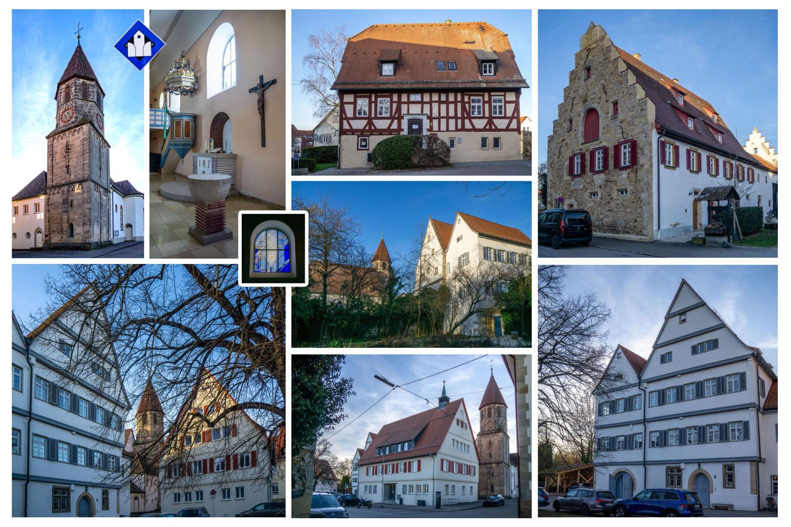
Deutsch: - Das alte Pfarrhaus (Klosterhof 4): Fachwerk-Wohnhaus (16. Jh.), Pfarrhaus bis 1838, heute Bildungs- und Kultureinrichtungen
- Die Ehem. Mesnerei und alten Schule (Klosterhof 6), 1826 durch einen Neubau ersetzt, mehrfach umgebaut, heute Verwaltung - Ev. Pfarrkirche (Klosterhof 8) [offene Kirche]: ehem. Probsteikirche St. Blasius, romanischer Turm (13. Jh.), 1926 Renovierung und Erweiterung - Rathaus (Klosterhof 10): 1954, an Stelle der ehem. Kellerei / württemb. Kanzlei (1649-1838), Rathaus seit 1844, heute Verwaltung - ehem. Probstei und Stabskellerei (ab 1649), seit 1836 Pfarrhaus (Klosterhof 12), heute Bürgermeisteramt - Fruchtkasten (Klosterhof 3) |
| Data | 22 fauré 2024, 17:57:18 (data di caricamento originaria) |
| Funtana | overview - direct - dataset |
| Autur | Willi Bautz |
| Lizënza (Tó ca danü chësc file) |
Creative Commons Zero (CC0) |
| ID | 933759 |
| Category | 1829 |
| Posizione del soggetto | | Posizione di questa e altre immagini su: OpenStreetMap |
|---|
This media file was collected by Landauf, LandApp under the ID 933759. This tag does not indicate the copyright status of the attached work. A normal copyright tag is still required. See Commons:Licensing. |
Lizënza
| Questo file è reso disponibile nei termini della licenza Creative Commons CC0 1.0 Universal. | |
| La persona che ha associato un'opera con questo atto legale ha donato tale opera nel pubblico dominio rinunciando a tutti i diritti sull'opera in tutto il mondo, inclusi tutti i diritti connessi o altri diritti simili, per quanto permesso dalla legge. Puoi copiare, modificare, distribuire ed utilizzare l'opera, anche a fini commerciali, senza chiedere alcun permesso.
|
Storia dl documënt
Druca sun na data/ëura per udëi l documënt coche l fo te chël mumënt.
| Data/Ëura | Miniatura | Grandëza | utënt | Cumentar | |
|---|---|---|---|---|---|
| atuel | 00:52, 24 fau 2024 | | 1 620 × 1 080 (330 KB) | LaserlichtBot | =={{int:filedesc}}== {{Information |description={{de|1=- Das alte Pfarrhaus (Klosterhof 4): Fachwerk-Wohnhaus (16. Jh.), Pfarrhaus bis 1838, heute Bildungs- und Kultureinrichtungen - Die Ehem. Mesnerei und alten Schule (Klosterhof 6), 1826 durch einen Neubau ersetzt, mehrfach umgebaut, heute Verwaltung - Ev. Pfarrkirche (Klosterhof 8) [offene Kirche]: ehem. Probsteikirche St. Blasius, romanischer Turm (13. Jh.), 1926 Renovierung und Erweiterung - Rathaus (Klosterhof 10): 1954, an Stelle d... |
Coche l document ie stat adurvà
Chësta plata adroa chësc documënt:
Coche l documënt ie stat adurvà ntëur l mond
Ënghe chësta wikis adroa chësc documënt:
- Adurvà sun ar.wikipedia.org
- Adurvà sun ce.wikipedia.org
- Adurvà sun de.wikivoyage.org
- Adurvà sun fr.wikipedia.org
- Adurvà sun fr.wikivoyage.org
- Adurvà sun hu.wikipedia.org
- Adurvà sun ku.wikipedia.org
- Adurvà sun lmo.wikipedia.org
- Adurvà sun mdf.wikipedia.org
- Adurvà sun pl.wikipedia.org
- Adurvà sun ro.wikipedia.org
- Adurvà sun ru.wikipedia.org
- Adurvà sun sr.wikipedia.org
- Adurvà sun tt.wikipedia.org
- Adurvà sun uz.wikipedia.org
- Adurvà sun vi.wikipedia.org
- Adurvà sun vo.wikipedia.org
- Adurvà sun www.wikidata.org