File:Myanmar location map.svg

Dimensioni di questa anteprima PNG per questo file SVG: 285 x 599 pixel. Autra resoluzions: 114 x 240 pixel | 228 x 480 pixel | 365 x 768 pixel | 487 x 1 024 pixel | 975 x 2 048 pixel | 1 200 x 2 520 pixel.
Documënt uriginel (file tl format SVG, dimenjiuns nominales 1 200 × 2 520 pixels, dimenjiun dl file: 633 KB)
Ressumé
| Descriziun |
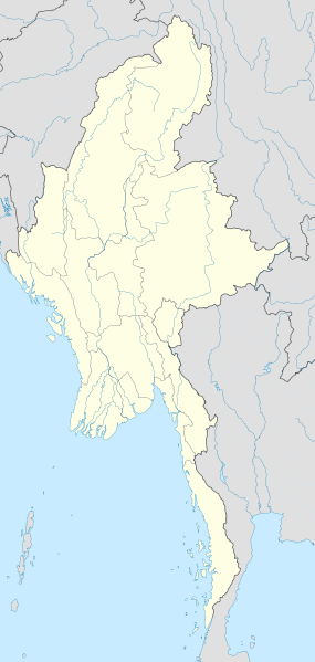
English: Location map of Myanmar. Equirectangular projection. Strechted by 105.0%. Geographic limits of the map: * N: 29.0° N * S: 9.0° N * W: 92.0° E * E: 102.0° E Made with Natural Earth. Free vector and raster map data @ naturalearthdata.com. |
| Data | |
| Funtana | Opera personala |
| Autur | Uwe Dedering |
Lizënza
Io, detentore del copyright su quest'opera, dichiaro di pubblicarla con le seguenti licenze:
Chësc file á la lizënza de destribuziun aladô dla lizënza Creative Commons Attribution-Share Alike 3.0 Unported.
- Tu ies liede:
- da spartì – per cupié, spartësc y manda l lëur
- da mudé – da adaté al lëur
- A chësta condizions:
- atribuzion – Tu mues atribué l lëur te la maniera che à spiegà l autëur o chël che à la lizënza (ma nia te na maniera che l smea che ëi te paiessa).
- fá na condivijiun tla medema manira – Sce te mudes o svilupeies chësc test, pudres mé spartì ora l lëur sota la medema lizënza o una che ti smea a chësta same or compatible license

|
AL é la lizënza da copié, da dé inant y/o müdé chësc documënt aladô dla lizënza GNU Free Documentation License, Verjiun 1.2 o vigni atra verjiun suandënta publicada dala Free Software Foundation; zënza seziuns che ara ne vá nia da mudé, zënza test söl cuertl ca dant y do ia. Na copia dla lizënza é tla seziun cun le titul Test dla GNU Free Documentation License. |
Pos chirí fora la lizënza che as plü ion
| Annotations | This image is annotated: View the annotations at Commons |
Storia dl documënt
Druca sun na data/ëura per udëi l documënt coche l fo te chël mumënt.
| Data/Ëura | Miniatura | Grandëza | utënt | Cumentar | |
|---|---|---|---|---|---|
| atuel | 18:08, 29 sët 2011 | | 1 200 × 2 520 (633 KB) | NordNordWest | corr, see disk |
| 19:45, 18 fau 2010 |  | 1 200 × 2 520 (968 KB) | Uwe Dedering | no disputed countries | |
| 15:03, 18 fau 2010 |  | 1 200 × 2 520 (974 KB) | Uwe Dedering | {{Information |Description={{en|1=Location map of Myanmar. Equirectangular projection. Strechted by 105.0%. Geographic limits of the map: * N: 29.0° N * S: 9.0° N * W: 92.0° E * E: 102.0° E Made with Natural Earth. Free vector and raster map dat |
Coche l document ie stat adurvà
Chësta plata adroa chësc documënt:
Coche l documënt ie stat adurvà ntëur l mond
Ënghe chësta wikis adroa chësc documënt:
- Adurvà sun af.wikipedia.org
- Adurvà sun an.wikipedia.org
- Adurvà sun ar.wikipedia.org
- Adurvà sun az.wikipedia.org
- Adurvà sun ba.wikipedia.org
- Adurvà sun be.wikipedia.org
- Adurvà sun bg.wikipedia.org
- Adurvà sun bh.wikipedia.org
- Adurvà sun bn.wikipedia.org
Mostra utilisaziun globala de chësc file.