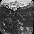
File:Parc d'Enfer et pic de Crabioules, vallée du Lys.jpg

Documënt uriginel(2 489 × 2 520 pixels, dimenjiun dl file: 877 KB, MIME type: image/jpeg)

Chësc documënt ven da Wikimedia Commons y po unì adurvà per autri proiec. Dessot ie la descrizion te la file description page.

Ressumé

Descriziun

Fonds Trutat - Photographie ancienne

Cote : TRU C 217 Localisation : Fonds ancien Original non communicable

Titre : Parc d'Enfer et pic de Crabioules, Luchon [environs], vallée du Lys

Auteur : Trutat, Eugène Rôle de l’auteur : Photographe

Lieu de création : Bagnères-de-Luchon (Haute-Garonne ; canton) Date de création : : 1859-1910 [entre]

Mesures : 10 x 9 cm Mot(s)-clé(s) : -- Montagne -- Gouffre -- Gorge -- Végétation -- Roche -- Crête (montagne) -- Pic (montagne) -- Neige

-- Bagnères-de-Luchon (Haute-Garonne ; canton) -- Lys, Vallée du (France) -- Crabioules (France ; pic) -- Enfer, Rue d' (France ; gorges) -- Luchonnais, Massif du (France)

-- 19e siècle, 2e moitié -- 20e siècle, 1e quart

Médium : Photographies -- Noir et blanc -- Positifs au collodion sur plaque de verre -- Paysages de montagne Bibliographie :

Frappé (Jean-Bernard). - Autrefois Bagnères de Luchon. Tome II. - Anglet : Atlantica, 2001. - 297 p. ; 15 x 22 cm. - (Autrefois) cf. p. 236-237

Bibliothèque de Toulouse. Domaine public
Data (between 1859 and 1910)
Funtana https://www.flickr.com/photos/26134435@N05/2555913018/sizes/o/
Autur Original by Eugène Trutat (Born in 1840 - Dead in 1910) - Scan on Flickr by Bibliothèque de Toulouse
Lizënza
(Tó ca danü chësc file)

Original picture (photo on glass) is in the public domain because its author died more than 70 years ago. The owner of the original picture (bibliothèque de Toulouse) made a scan and released it on Flickr with the mention "no known copyright restrictions":

«Bibliothèque de Toulouse is a member of The Commons on Flickr. Bibliothèque de Toulouse images that are part of The Commons are marked as "no known copyright restrictions," indicating that the Library is unaware of any current copyright restrictions on the works so designated, either because the term of copyright may have expired without being renewed or because no evidence has been found that copyright restrictions apply» (source)
Luogo dello scatto42° 46′ 49,47″ N, 0° 35′ 52,43″ E Kartographer map based on OpenStreetMap.Posizione di questa e altre immagini su: OpenStreetMapinfo

Lizënza

Public domain

Quest'opera è nel pubblico dominio anche in tutti i Paesi e nelle aree in cui la durata del copyright è la vita dell'autore più 70 anni o meno.


Devi inserire anche un tag per il pubblico dominio relativo agli Stati Uniti per indicare perché quest'opera è nel pubblico dominio negli Stati Uniti. Nota che in alcuni Paesi i termini del copyright durano più di 70 anni: in Messico 100, in Giamaica 95, in Colombia 80, in Guatemala e Samoa 75 anni. Questa immagine potrebbe non essere nel pubblico dominio in questi Paesi, che inoltre non applicano la regola della durata più breve. L'Honduras ha un termine generale di 75 anni, ma questo paese applica la regola della durata più breve.

This image, originally posted to Flickr, was reviewed on 10 July 2008 by the administrator or reviewer Guérin Nicolas, who confirmed that it was available on Flickr under the stated license on that date.

Didascalie

Aggiungi una brevissima spiegazione di ciò che questo file rappresenta

Elementi ritratti in questo file

raffigura italiano

42°46'49.472"N, 0°35'52.426"E

tipo di file italiano

image/jpeg

checksum italiano

afc9b62bbcdd5ec66d3cea783fe5cba4205b9d14

metodo di determinazione italiano: SHA-1 italiano

dimensione dati italiano

898 402 byte

altezza italiano

2 520 pixel

larghezza italiano

2 489 pixel

Storia dl documënt

Druca sun na data/ëura per udëi l documënt coche l fo te chël mumënt.

Data/ËuraMiniaturaGrandëzautëntCumentar
atuel00:29, 11 lug 2008Miniatura de la version de la 00:29, 11 lug 20082 489 × 2 520 (877 KB)Guérin Nicolas{{Information |Description= Fonds Trutat - Photographie ancienne '''Cote :''' TRU C 217 '''Localisation :''' Fonds ancien Original non communicable '''Titre :''' Parc d'Enfer et pic de Crabioules, Luchon [environs], vallée du Lys '''Auteur :''' Trutat

Chësta plata adroa chësc documënt:

Coche l documënt ie stat adurvà ntëur l mond

Ënghe chësta wikis adroa chësc documënt: