File:Prince William's Parish Church (Ruins), Sheldon vicinity (Beaufort County, South Carolina).jpg

Prince_William's_Parish_Church_(Ruins),_Sheldon_vicinity_(Beaufort_County,_South_Carolina).jpg(588 × 411 pixels, dimenjiun dl file: 131 KB, MIME type: image/jpeg)

Chësc documënt ven da Wikimedia Commons y po unì adurvà per autri proiec. Dessot ie la descrizion te la file description page.

Questa è un'immagine di un luogo o edificio che è elencato nel National Register of Historic Places negli Stati Uniti. Il suo numero di riferimento è [https://npgallery.nps.gov/AssetDetail/NRIS/70000562 . 70000562 .].

Descriziun
English: Prince William's Parish Church (Ruins), Sheldon vicinity (Beaufort County, South Carolina) - (cropped)
This file comes from the Historic American Buildings Survey (HABS), Historic American Engineering Record (HAER) or Historic American Landscapes Survey (HALS). These are programs of the National Park Service established for the purpose of documenting historic places. Records consist of measured drawings, archival photographs, and written reports.

This tag does not indicate the copyright status of the attached work. A normal copyright tag is still required. See Commons:Licensing.

Public domain This image or media file contains material based on a work of a National Park Service employee, created as part of that person's official duties. As a work of the U.S. federal government, such work is in the public domain in the United States. See the NPS website and NPS copyright policy for more information.
Posizione del soggetto32° 37′ 06,7″ N, 80° 46′ 49,7″ W Kartographer map based on OpenStreetMap.Posizione di questa e altre immagini su: OpenStreetMapinfo
Data
Funtana http://memory.loc.gov/cgi-bin/displayPhoto.pl?path=/pnp/habshaer/sc/sc0200/sc0277/photos&topImages=151946pr.jpg&topLinks=151946pv.jpg,151946pu.tif&title=HABS%20SC,7-SHELD,1-1&displayProfile=0
Autur SconosciutoUnknown author
Lizënza
(Tó ca danü chësc file)
This file comes from the Historic American Buildings Survey (HABS), Historic American Engineering Record (HAER) or Historic American Landscapes Survey (HALS). These are programs of the National Park Service established for the purpose of documenting historic places. Records consist of measured drawings, archival photographs, and written reports.


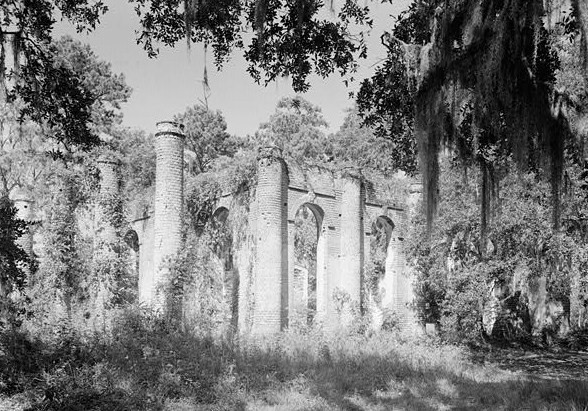
When reusing please credit: Library of Congress, Prints & Photographs Division, SC,7-SHELD,1-1
This tag does not indicate the copyright status of the attached work. A normal copyright tag is still required. See Commons:Licensing.

Public domain This image or media file contains material based on a work of a National Park Service employee, created as part of that person's official duties. As a work of the U.S. federal government, such work is in the public domain in the United States. See the NPS website and NPS copyright policy for more information.

Didascalie

Aggiungi una brevissima spiegazione di ciò che questo file rappresenta

Elementi ritratti in questo file

raffigura italiano

rovine italiano

32°37'6.701"N, 80°46'49.699"W

tipo di file italiano

image/jpeg

Storia dl documënt

Druca sun na data/ëura per udëi l documënt coche l fo te chël mumënt.

Data/ËuraMiniaturaGrandëzautëntCumentar
atuel21:27, 4 lug 2008Miniatura de la version de la 21:27, 4 lug 2008588 × 411 (131 KB)KudzuVine{{Information |Description={{en|1=Prince William's Parish Church (Ruins), Sheldon vicinity (Beaufort County, South Carolina) - (cropped) {{PD-USGov-Interior-HABS}}}} |Source=http://memory.loc.gov/cgi-bin/displayPhoto.pl?path=/pnp/habshaer/sc/sc0200/sc0277

Chësta plata adroa chësc documënt:

Coche l documënt ie stat adurvà ntëur l mond

Ënghe chësta wikis adroa chësc documënt:

Metadac