File:Sweden Kalmar location map.svg

Dimensioni di questa anteprima PNG per questo file SVG: 327 x 599 pixel. Autra resoluzions: 131 x 240 pixel | 262 x 480 pixel | 419 x 768 pixel | 559 x 1 024 pixel | 1 118 x 2 048 pixel | 546 x 1 000 pixel.
Documënt uriginel (file tl format SVG, dimenjiuns nominales 546 × 1 000 pixels, dimenjiun dl file: 217 KB)
Ressumé
| Descriziun |
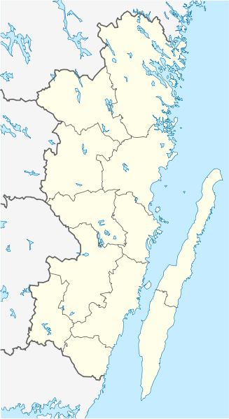
English: Location map of Kalmar County in Sweden. N-S stretching is 183%, geographic limits of the map:
Deutsch: Positionskarte von Kalmar län in Schweden. N-S-Streckung beträgt 183%, geographische Begrenzung der Karte:
|
| Data | |
| Funtana | Opera personala |
| Autur | Erik Frohne |
| Altre versioni | Opere derivate da questo file: Öland Municipal centres.svg |
Lizënza
Io, detentore del copyright su quest'opera, dichiaro di pubblicarla con le seguenti licenze:

|
AL é la lizënza da copié, da dé inant y/o müdé chësc documënt aladô dla lizënza GNU Free Documentation License, Verjiun 1.2 o vigni atra verjiun suandënta publicada dala Free Software Foundation; zënza seziuns che ara ne vá nia da mudé, zënza test söl cuertl ca dant y do ia. Na copia dla lizënza é tla seziun cun le titul Test dla GNU Free Documentation License. |
Questo file è disponibile in base alla licenza Creative Commons Attribuzione 3.0 Unported
- Tu ies liede:
- da spartì – per cupié, spartësc y manda l lëur
- da mudé – da adaté al lëur
- A chësta condizions:
- atribuzion – Tu mues atribué l lëur te la maniera che à spiegà l autëur o chël che à la lizënza (ma nia te na maniera che l smea che ëi te paiessa).
Pos chirí fora la lizënza che as plü ion
Storia dl documënt
Druca sun na data/ëura per udëi l documënt coche l fo te chël mumënt.
| Data/Ëura | Miniatura | Grandëza | utënt | Cumentar | |
|---|---|---|---|---|---|
| atuel | 10:23, 27 jen 2009 | | 546 × 1 000 (217 KB) | Erik Frohne | Waterline adjusted |
| 18:26, 18 jen 2009 |  | 546 × 1 000 (216 KB) | Erik Frohne | Added some lakes Category:Location maps of Sweden | |
| 11:58, 17 jen 2009 |  | 546 × 1 000 (183 KB) | Erik Frohne | {{Information |Description={{en|1=Location map of Kalmar in Sweden. N-S stretching is 183%, geographic limits of the map: * N: 58.20° N * S: 56.10° N * W: 15.10° E * E: 17.20° E }} {{de|1=Positionskarte von Kalmar in Sweden. N-S-Streckung beträgt 18 |
Coche l document ie stat adurvà
Chësta plata adroa chësc documënt:
Coche l documënt ie stat adurvà ntëur l mond
Ënghe chësta wikis adroa chësc documënt:
- Adurvà sun ar.wikipedia.org
- Adurvà sun arz.wikipedia.org
- Adurvà sun bg.wikipedia.org
- Adurvà sun ca.wikipedia.org
- Adurvà sun ceb.wikipedia.org
- Adurvà sun cs.wikipedia.org
- Adurvà sun da.wikipedia.org
Mostra utilisaziun globala de chësc file.