File:WarMemorialFakenham(PhilipHalling)Jul2006.jpg
Dimenjiuns de chësta odüda danfora:450 x 600 pixel. Autra resoluzions: 180 x 240 pixel | 480 x 640 pixel.
Documënt uriginel (480 × 640 pixels, dimenjiun dl file: 107 KB, MIME type: image/jpeg)
Jul2006.jpg)
| Descriziun |
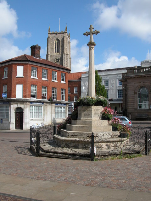
English: Picture of the war memorial in Fakenham, Norfolk, England showing the tower of the church of St Peter and St Paul in the background |
| Data | |
| Funtana | From geograph.org.uk |
| Autur | Philip Halling |
| Lizënza (Tó ca danü chësc file) |
Creative Commons Attribution Share-alike license 2.0 |
| Luogo dello scatto | | Posizione di questa e altre immagini su: OpenStreetMap |
|---|
Jul2006.jpg¶ms=052.829740_N_0000.847070_E_globe:Earth_type:camera_heading:337.00&language=lld)

|
Questa immagine proviene dalla collezione del progetto Geograph. Vedi questa fotografia sul sito web di Geograph per visualizzare i dettagli relativi al fotografo. Il copyright di questa immagine appartiene a Philip Halling ed è pubblicata secondo i termini della licenza Creative Commons Attribuzione-Condividi allo stesso modo 2.0.
|
Questo file è disponibile in base alla licenza Creative Commons Attribuzione-Condividi allo stesso modo 2.0 Generico
Atribuzion: Philip Halling
- Tu ies liede:
- da spartì – per cupié, spartësc y manda l lëur
- da mudé – da adaté al lëur
- A chësta condizions:
- atribuzion – Tu mues atribué l lëur te la maniera che à spiegà l autëur o chël che à la lizënza (ma nia te na maniera che l smea che ëi te paiessa).
- fá na condivijiun tla medema manira – Sce te mudes o svilupeies chësc test, pudres mé spartì ora l lëur sota la medema lizënza o una che ti smea a chësta same or compatible license
Registro originale del caricamento
The original description page was here. All following user names refer to en.wikipedia.
- 2006-08-30 06:30 Euchiasmus 480×640×??? (109871 bytes) Picture of the war memorial in Fakenham, Norfolk, England showing the tower of the church of St Peter and St Paul in the background taken by Philip Halling in 2006 and placed on the geograph website under a Creative Commons License. Image can be seen at
Storia dl documënt
Druca sun na data/ëura per udëi l documënt coche l fo te chël mumënt.
| Data/Ëura | Miniatura | Grandëza | utënt | Cumentar | |
|---|---|---|---|---|---|
| atuel | 16:50, 1 sët 2008 | | 480 × 640 (107 KB) | Angusmclellan | {{Information |Description={en|Picture of the war memorial in Fakenham, Norfolk, England showing the tower of the church of St Peter and St Paul in the background}} |Source=From [http://www.geograph.org.uk/photo/203578 geograph.org.uk] |Date=200 |
Coche l document ie stat adurvà
Chësta plata adroa chësc documënt:
Coche l documënt ie stat adurvà ntëur l mond
Ënghe chësta wikis adroa chësc documënt:
- Adurvà sun af.wikipedia.org
- Adurvà sun azb.wikipedia.org
- Adurvà sun ceb.wikipedia.org
- Adurvà sun cy.wikipedia.org
- Adurvà sun de.wikipedia.org
- Adurvà sun en.wikipedia.org
- Adurvà sun en.wikivoyage.org
- Adurvà sun es.wikipedia.org
- Adurvà sun fa.wikipedia.org
- Adurvà sun fr.wikipedia.org
- Adurvà sun ga.wikipedia.org
- Adurvà sun it.wikipedia.org
- Adurvà sun nl.wikipedia.org
- Adurvà sun nn.wikipedia.org
- Adurvà sun no.wikipedia.org
- Adurvà sun pl.wikipedia.org
- Adurvà sun pl.wikivoyage.org
- Adurvà sun ro.wikipedia.org
- Adurvà sun sv.wikipedia.org
- Adurvà sun tr.wikipedia.org
- Adurvà sun www.wikidata.org
- Adurvà sun zh.wikipedia.org
Jul2006.jpg)